 This theme will provide a better understanding of linkages between seabed physical features and ecological processes that sustain important areas for marine biodiversity including Key Ecological Features (KEFs), estimate and test connectivity between these important areas and those areas being actively managed for biodiversity conservation (eg. CMRs), and provide the long-term perspective on biodiversity dynamics to inform future management under climate change.
The research will support implementation of Marine Bioregional Plans by providing new data, maps and interpretations (e.g. inputs to Marine Conservation Atlas) to inform assessments under the Environment Protection and Biodiversity Conservation Act, such as those for commercial fisheries or assessment of activities associated with oil and gas exploration and production. This project will also contribute to the strategic longer-term need to progressively develop our capacity to understand and communicate national patterns of marine biodiversity (e.g. through future iterations of the Integrated Marine and Coastal Regionalisation of Australia that may be required in the longer-term).
Six outputs of this theme will be:
- Maps/GIS layers incorporating the best available existing data, that describe the physical features, processes and patterns of biodiversity in targeted areas of the continental shelf in Northern Australia
- Models (conceptual, qualitative & quantitative) that describe how the morphology and local oceanography of large-scale physical features influences their value to biodiversity
- Recommend an analytical template for characterising and assessing the significance for biodiversity of key physical and ecological features throughout the Australian Marine Estate, especially those that have not been well-sampled
- An atlas illustrating major patterns of species and genetic biodiversity of three major faunal groups across Australia's marine domain.
- National maps/GIS layers of hotspots of biological and genetic diversity,
- Exploration of the possible causes and management implications of major biodiversity patterns.
Outputs from this theme will be used in the Supporting management of marine biodiversity theme (integrating social, economic and environmental values project) to value marine biodiversity and may influence monitoring decisions in National monitoring, evaluation and reporting theme.
Three outcomes of this theme will be:
- A considered understanding of the importance of the physical environment of seafloor features for their value to biodiversity, including connectivity between areas of management interest (eg. KEFs and CMRs)
- Increased capacity for understanding patterns of biodiversity through further building the national evidence-base
- Increased capacity for managing off-reserve activities at the spatial scales representing patterns in biodiversity
Related information:
- Refer to Annual Work Plan 2014 for current project information
Images:
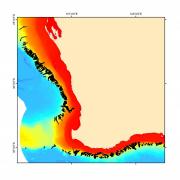
(above) Submarine canyons off south-western Western Australia. The Marine Biodiversity Hub is evaluating the physical variation and biodiversity potential of Australian canyons. (Image: Geoscience Australia)
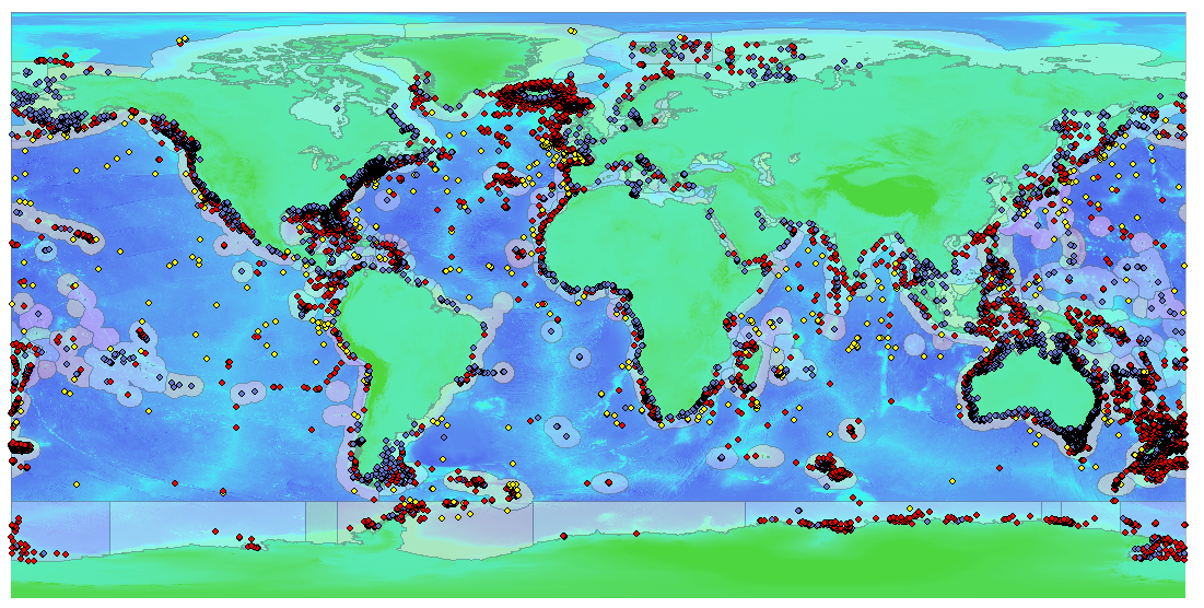
(below) Locations of brittle star samples destined to contribute to the global mapping project. Blue dots: continental shelves; red dots: bathyl; yellow dots: abyssal. (Image: Museum Victoria)