October 30, 2013
A computer-aided project to process and store visual underwater data from around Australia will, for the first time, enable continental-scale analysis of marine ecosystems, according to researchers from the NERP Marine Biodiversity Hub.
Applications include monitoring to support marine bioregional plans and management of the Commonwealth marine reserve network.
The collaborative national project, CATAMI (Collaborative and Automated Tools for Analysis of Marine Imagery and Video) combines a new classification system that ensures marine life forms seen on underwater images are given consistent names, with a web application to enable researchers to input, process, store and compare visual data.
According to Dr Nicole Hill, an Institute for Marine and Antarctic Studies post-doctoral researcher with the Marine Hub, analysing visual data is a non-destructive way of assessing both the physical and biological marine environment. It has particular relevance for improving understanding about the marine communities protected by marine reserves and monitoring how these marine communities change through time.
‘Once we have the imagery, we need to extract meaningful evidence for managers that provides insights about progress toward management objectives, such as improved ecological understanding or mitigation of undesirable impacts,’ she said.
CATAMI delivers a standardised framework to maximise the value of the data by making sure everyone is speaking a common “language".
By having the data in a common format, in the one place, researchers can compare and/or aggregate data sets collected by different institutions to answer broad-scale questions relevant to agencies such as the Commonwealth Department of the Environment.
According to Franzis Althaus, who has been analysing visual data at CSIRO for 13 years and is applying this knowledge to Marine Hub research, species-level identification isn’t always possible from visual data.
'We needed a hierarchical classification system that labels marine life in consistent ways. For example, at the most general level, a seaweed might be classed as ‘macroalgae’, then, more specifically, as ‘erect coarse-branching’, and, finally, as ‘brown’, ‘red’ or ‘green’ algae', Franzis Althaus said.
Different levels of detail are required for different purposes. Broad-scale questions that CATAMI will help answer could include: What is the distribution and relative abundance of corals across tropical Australia? What does the change in abundance of an indicator species (or broad organism type, eg tall sponges) tell us about fishing pressure off Australia’s coasts? How are Australia’s marine communities changing with the climate?
According to Mr Mathew Wyatt, technical manager leading the development team of CATAMI, one aim is to make the processing of visual images faster.
‘There is a lot more of this image data being collected, at a far greater rate than humans can possibly keep up with,’ Mr Wyatt said.
Through CATAMI we are speeding up the process by teaching the computer to recognise similar marine images, which it can then recommend to a researcher for similar classification (eg 80 percent sand and 20 percent coral), in much the same way as AMAZON recommends similar books to a reader.
But CATAMI is broader than that, according to Mr Wyatt, with other efficiencies expected to flow from having CATAMI act as a repository for marine data and having scientists from different institutions able to access it online at the same time, encouraging a collaborative environment and producing data that can be aggregated.
The project — an Australian National Data Service (ANDS) and National eResearch Collaboration Tools and Resources (NeCTAR) initiative — has benefited from collaboration, including a series of workshops involving researchers from the Marine Hub, universities and States, Dr Hill added.
CATAMI will contribute to the national blueprint being developed to monitor marine ecosystem health and the Commonwealth marine reserve network.
Acknowledgements
This project includes development funded by ANDS and NeCTAR. ANDS is supported by the Australian Government through the National Collaborative Research Infrastructure Strategy Program and the Education Investment Fund (EIF) Super Science Initiative. NeCTAR is an Australian Government project conducted as part of the Super Science initiative and financed by the Education Investment Fund.
Further reading
- Classification scheme available as a PDF
- CATAMI
- Commonwealth marine reserves
- A blueprint for ecosystem health monitoring across the EEZ
- News item - New collaborative and automated tools for analysis of marine imagery and video - March 2013
- Request the new CATAMI poster "Putting names to a sea of faces"
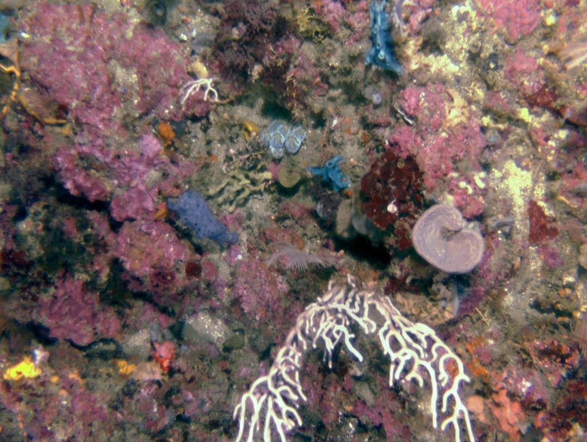
Image:
Marine Hub researchers using visual data to monitor marine environments in the Solitary Islands Marine Reserve and the Flinders Commonwealth Marine Reserve are using the standardised classification scheme developed through CATAMI, and available as a PDF, to label biota and substrata. The rich supply of visual images previously collected from waters around Australia can also be incorporated via the CATAMI web interface and re-labelled according to the new classification scheme, maximising the value of existing marine data and further supporting monitoring needs. This image was taken at the Solitary Islands. Image: Nicole Hill, University of Tasmania
Contact
Dr Nicole Hill, University of Tasmania
- Log in to post comments